MATA is located at Arlington Municipal Airport (AWO), just a few miles west of the foothills ascending to the Cascade Range, with Mt. Baker (10,800′) only 39 nm north, Glacier Peak (10,560′) 43 nm east, and majestic Mt. Rainier (14,410′) very visible on clear days 81 nm southeast. Despite the proximity to mountainous terrain, the field elevation is just over 100′ MSL, because we are on a narrow strip of lowland less than 10 miles east of Puget Sound.
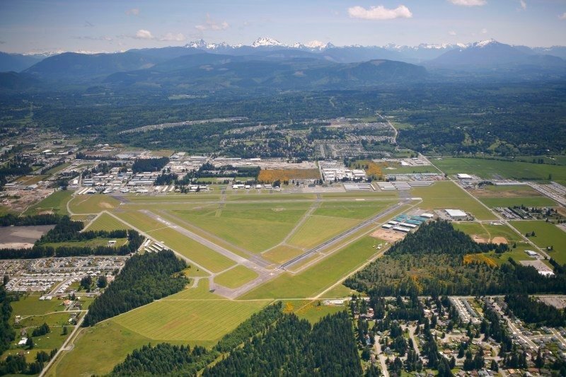
Eastward view, with Three Fingers (about 7,000′ MSL,19 nm beyond Arlington Muni) slightly left of the horizon’s center, and Glacier Peak(10,560′ MSL, 43 nm beyond the airport) just to the right. There are half a dozen public airstrips in the Cascade Range within about 60nm of Arlington Muni, which are open in the summer and present challenging training opportunities.
Northerly view of primary runway (Rwy 34, 5,300′ x 100′), served by LOC, GPS, and NDB approaches. The grass strip further to the right, immediately to the right of runway 34, is a glider operating surface. Snow-capped Mt. Baker (10,800′) is visible in the background.
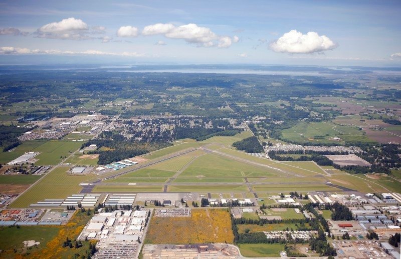
Westward view, with Puget Sound, Camano Island, and Whidbey Island in the background, and the Olympic Mountains barely discernible on the horizon at the left edge of the photo.
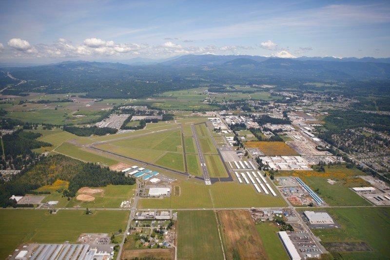
View of the crosswind runway (Rwy 29, 3,500′ x 75′), with Whidbey Island straight out the centerline. Beyond Whidbey Island Naval Air Station, which is in Class C airspace, there are half a dozen airports on the San Juans, a cluster of islands within 50 nm of Arlington Municipal Airport.